
Warming seas and stronger storms:
The dialogue between sea and sky in the Mediterranean
The Mediterranean, ‘the sea between lands,’ has long been a cradle of cultures and discovery. Stretching across three continents and touching 21 nations, it’s home to more than 540 million people.
Today, it is one of the most vibrant, but also pressured seas in the world.
The Mediterranean Sea case study
As a miniature version of the world's oceans set in a rapidly warming region, the Mediterranean Sea is a living laboratory at Europe's doorstep, offering a deeper understanding of ocean and atmosphere interactions in the era of climate change.
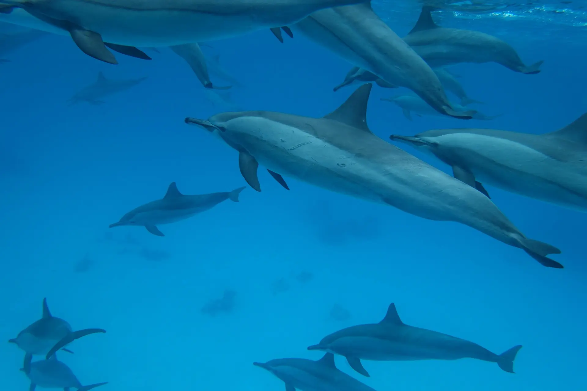
Global records for ocean heat and temperature have been broken repeatedly in the last decade, highlighting the pace of change taking place.
Ocean temperatures have risen on average by 0.5ºC since 1982.2
The ocean absorbs around 90% of the excess heat generated by human activity, acting as a vast and steady buffer within the climate system.
Annual sea surface temperature in Celsius from My Ocean Health.1
The Mediterranean Sea is warming about 20% faster than the global average.3
Summer heat scorches the sea

1995
2010
2024
Rising temperatures have turned the Mediterranean region into a hot spot for two natural phenomena: marine heat waves and medicanes.
While marine heatwaves are spikes of extreme ocean temperatures that are becoming a new normal, Medicanes are rare, hurricane-like storms that are expected to grow in intensity as sea waters continue to warm.
Marine heatwaves spread through the sea
Detected from space, marine heatwaves first reveal themselves at the ocean's surface. Defined as localised periods of extreme ocean warmth, marine heatwaves can extend far below the surface, affecting the layers of ocean water in ways that are largely invisible, but consequential for ocean life.
In the Mediterranean, these events are becoming more frequent, more intense, and more prolonged as sea surface temperatures rise.
Whereas in the 1980s the Mediterranean Sea experienced approximately one heatwave a year, affecting a small portion of the sea, in the last two decades, the sea experienced four heatwaves a year, affecting almost 100% of the Mediterranean Sea.5
Three years, 1990, 2003, and 2022, are representative of the beginning, middle, and end of the 1982-2022 time period, illustrating how marine heatwaves have expanded over time in the Mediterranean Sea.5
In May 2022, an exceptional marine heatwave began in the Northwestern Mediterranean Sea and persisted until the end of the year, breaking records in duration and intensity, and reaching up to 6°C above typical conditions.6
Researchers with ESA's CAREHeat project captured the extent of the heatwave and discovered that the record-breaking summer heatwave persisted far below the ocean surface, affecting waters as deep as 70-80 meters at some locations.6
May 2022
August 2022
November 2022
Winter's unseen threat
Although heatwaves make the headlines every summer in the Mediterranean region, marine heatwaves extending into or occurring during the winter months are especially disruptive to the rhythms of ocean life.
During winter, storms and strong ocean currents normally bring cold, nutrient-rich water up to the surface, feeding microscopic plants called phytoplankton. In late winter to early spring, the surge of nutrients and milder temperatures sparks the spring blooms of these tiny surface algae.
These blooms are the foundation of the entire ocean food web, from tiny zooplankton to the largest fish in the sea.
During winter, storms and strong ocean currents normally bring cold, nutrient-rich water up to the surface, feeding microscopic plants called phytoplankton. In late winter to early spring, the surge of nutrients and milder temperatures sparks the spring blooms of these tiny surface algae.
These blooms are the foundation of the entire ocean food web, from tiny zooplankton to the largest fish in the sea.
By combining satellite images with profiling floats drifting through the sea, CAREHeat research has shown, for the first time, that over the past decade winter heatwaves in the Northwest Mediterranean have consistently weakened spring phytoplankton blooms. 7
Argo floats track the Mediterranean Sea's response to heatwaves
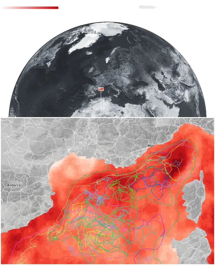
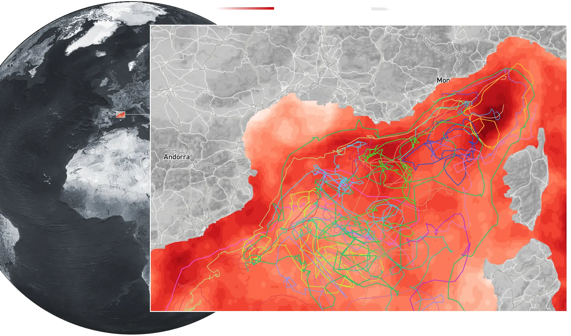
The trajectories of 23 Argo floats used to collect data at different depths. Trajectories are superimposed over the frequencies of marine heat waves between 2012-2022.7
Argo floats submerge to different depths and then slowly rise, while sampling the biological and chemical properties of the water.
Heat in the sea affects sea life
Strong mixing
When ocean water from different depths mix together, nutrients found in abundance on the ocean floor rise to nourish phytoplankton found only in the surface layers.
No stratification
High nutrient flux
Weak mixing
Warmer winter surface waters can suppress storm-driven mixing, keeping nutrient-rich deep waters out of reach of phytoplankton in the upper ocean.
Strong stratification
Low nutrient flux
Rosalia Santoleri, former Director at the Institute of Marine Science at the Italian National Research Council and lead scientist for CAREHeat, explains the significance after the project research,
This is the first study to provide quantified evidence that marine heatwaves affect phytoplankton. Scientists suspected this link, but until now it hadn't been measured. Achieving this required pulling together all the pieces in one location: satellite observations, bio-Argo floats, and long-term in-situ measurements from climate stations like Lampedusa, where both atmospheric and biological changes in the water column are tracked at depths in the sea over time.
When models, satellites, and on-the-water observations come together, new understanding emerges of the changing Mediterranean Sea, allowing society to track ocean extremes as they unfold, spot warning signs earlier, and act before impacts run too deep.
Medicanes:
A clearer picture of the Mediterranean's strongest storms
Rising marine temperatures don't only disrupt life beneath the surface of the ocean. When the ocean is filled with excess heat, it influences the atmosphere above it, sometimes with dramatic consequences.
A medicane, a blend of the words Mediterranean and hurricane, is a type of high impact cyclone that gathers strength from ocean conditions in the same manner as a tropical cyclone. Prior research has detected that these powerful storms have long occurred in the Mediterranean, although rarely.
In September 2020, Medicane Ianos originated over northern Libya and crisscrossed an unusually warm Mediterranean Sea on a 1900 km trek, hitting the Greek mainland and the Ionian islands when it was at its most powerful.
Over 7 days between the 15th and 21st of September 2020 Ianos crossed the Mediterranean Sea.
Ianos gained strength and was first tracked by satellite off the coast of Libya over the Gulf of Sidra where sea surface temperatures exceeded 28º C, 2º warmer than average.
Ianos began as a typical storm, caused by clashing air currents in the atmosphere, but when it moved over the unusually warm Gulf of Sidra and into the Ionian Sea, the hot, humid air rising off the sea transformed it into a dangerous medicane.
Warmer sea surface temperatures create a more humid atmosphere, and this influences how storms evolve into medicanes, making them more intense and increasing wind speeds.
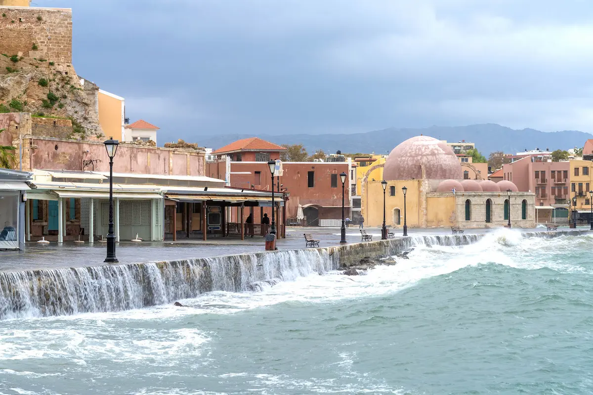
Hurricane force winds reaching 100 km per hour swept away boats in the Greek harbor, damaged infrastructure, uprooted trees, and created storm surges that flooded communities.
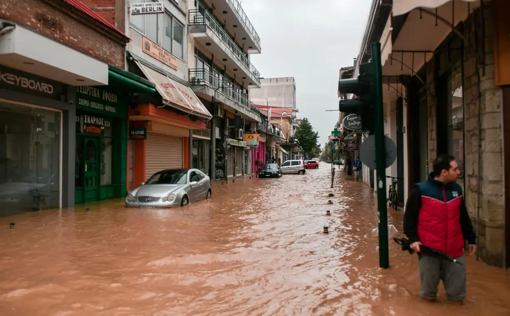
Torrential rainfall caused rivers to overflow, and resulted in over 1400 landslides over two days.
Thousands of homes and businesses were flooded, residents were trapped, and four people were killed in the storm.
After landfall, Ianos crossed back over the sea before dissipating on Sept 21st.
15 September
WEkEO8

Data fuels discovery: capturing a medicane for the first time
Ianos was the most intense medicane recorded since the 2000s, and it was also the first time that scientists were able to see through the clouds, into the internal structure of a medicane during its mature phase.
While Ianos was battering Greece, the Global Precipitation Measurement (GPM) Core Observatory—a special type of satellite flying at low orbit—made multiple passes over the Mediterranean and succeeded in capturing a medicane at its maximum intensity for the first time.
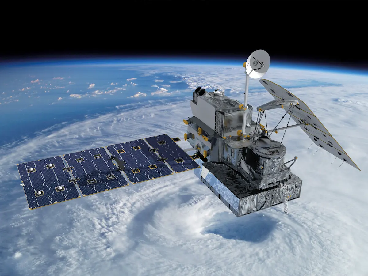
The Global Precipitation Measurement mission includes Low Earth Orbiting (LEO) satellites orbiting between 400-800 km from the Earth that see a relatively narrow swath of the Earth's surface at any given time they make a pass over a particular region. These satellites are operated by a large consortium of international space agencies, including the European Organisation for the Exploitation of Meteorological Satellites (EUMETSAT).
The storm top heights of Ianos
Microwave precipitation radar carried on the GPM Core Observatory gave scientists a 3-dimensional understanding of how the medicane developed, and provided a view of precipitation structure and storm top heights.
3D view of Ianos Storm Top Height during its most intense phase, derived from the NASA/JAXA GPM spaceborne precipitation radar.9
A storm top height reaching 12 km—unusually deep for medicanes—highlights the exceptional strength and underscores the peculiar intensity of Medicane Ianos, the most intense medicane on record.
From insight to application
In their recent paper, Defining Medicanes: Bridging the Knowledge Gap between Tropical and Extratropical Cyclones in the Mediterranean, ESA Medicanes Project researchers determined that certain features, detectable with Earth Observation, can be used as a defining criteria to more quickly identify medicanes, helping improve early detection and warning systems.10
Medicane features detectable with Earth observation
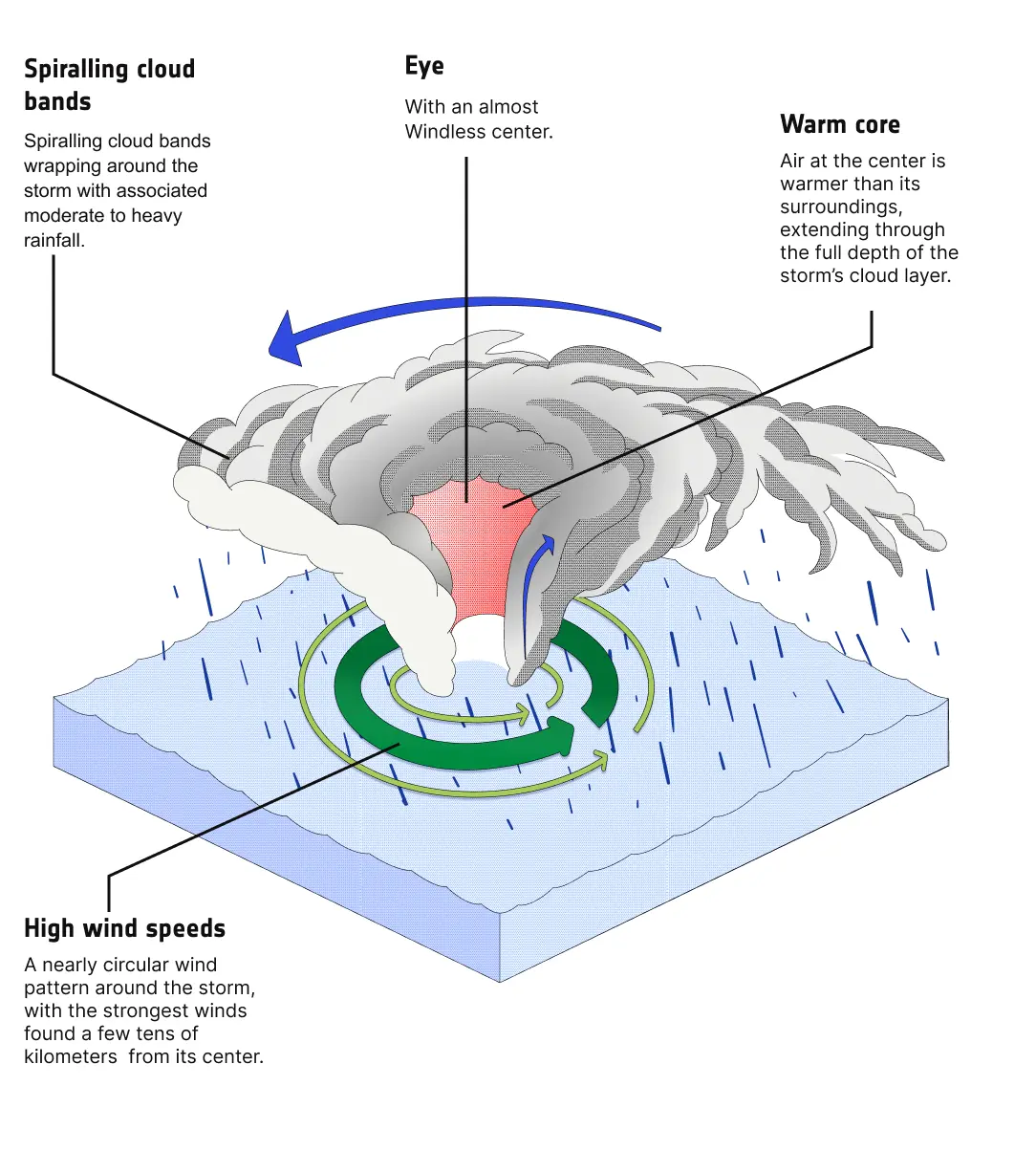
Instead of a definition based on complex underlying processes, we needed a definition that is quick, easy to recognize, and practical for issuing warnings. The solution was to base the definition solely on observable features, including those that resemble the characteristics of a tropical cyclone.- Giulia Panegrossi, ESA MEDICANES Project Coordinator, Director of Research CNR-ISAC
What's next?
More powerful medicanes make timely forecasts and early warnings increasingly important.
To meet the rising threat, ESA Medicanes scientists are integrating Earth observation data in predictive models, and sharpening their understanding of how and where these storms are likely to trigger coastal hazards like storm surges, flooding, landslides, and hurricane force winds which often occur simultaneously or in quick succession.
A system wide impact
From the heat accumulating in the ocean, to the storm systems that form above it, ESA research plays an important role in understanding how climate change is impacting the Mediterranean Sea. Satellites paired with in-situ sensors and advanced modeling strengthen Europe's early warning systems, and build the capacity to both protect ecosystems and to safeguard communities at the water's edge.
Aerial view of Cádiz, 2017


About
The production of this interactive story has been possible thanks to the efforts of Lobelia with the support of the CAREHeat and the Medicanes projects. This story has been prepared under ESA EO Science for Society funding in the context of the ESA project Edukeo.
The basemap is Lobelia Oceans Dark, which uses data by ©OpenStreetMap contributors.
References
- Copernicus Marine Service. My Ocean Health .
- Copernicus Marine Service. Sea Surface Temperature.
- MedECC. Cramer, W., Guiot, J., Marini, K. (eds.) (2020) Climate and Environmental Change in the Mediterranean Basin - Current Situation and Risks for the Future. First Mediterranean Assessment Report. Union for the Mediterranean, Plan Bleu, UNEP/MAP, Marseille, France. doi: 10.5281/zenodo.4768833
- Copernicus My Ocean Pro. Mediterranean Sea Surface Temperature, Annual Average and Monthly Average datasets.
- Martínez J, Leonelli FE, García-Ladona E, Garrabou J, Kersting DK, Bensoussan N and Pisano A (2023) Evolution of marine heatwaves in warming seas: the Mediterranean Sea case study. Front. Mar. Sci., 30 Volume 10 Sec. Physical Oceanography doi: 10.3389/fmars.2023.1193164
- Marullo et al. (2023) Record-breaking persistence of the 2022/23 marine heatwave in the Mediterranean Sea. Environmental Research Letters Volume 18. doi: 10.1088/1748-9326/ad02ae
- Li, M., Organelli, E., Serva, F., Bellacicco, M., Landolfi, A., Pisano, A., et al. (2024). Phytoplankton Spring Bloom Inhibited by Marine Heatwaves in the North-Western Mediterranean Sea. Sea. Geophysical Research Letters, 51, e2024GL109141. doi: 10.1029/2024GL109141.
- WEkEO: 10 metre wind speed, CERRA sub-daily regional reanalysis data for Europe on single levels.
- Leo Pio D'Adderio, Daniele Casella, Stefano Dietrich, Paolo Sanò, Giulia Panegrossi. (2022) GPM-CO observations of Medicane Ianos: Comparative analysis of precipitation structure between development and mature phase, Atmospheric Research, Volume 273, doi: 10.1016/j.atmosres.2022.106174
- Miglietta, M., Flaounas, E., González-Alemán J., Panegrossi G., et al. (2025) Defining Medicanes: Bridging the Knowledge Gap between Tropical and Extratropical Cyclones in the Mediterranean. Bulletin of the American Meteorological Society. doi: 10.1175/BAMS-D-24-0289.1
Images and Videos
- Riflemen's shoal on the reef / Istock by Getty Images.
- Dolphin / Pixabay.
- Giant trevally / Pixabay.
- Green swirling phytoplankton seen from space by the Copernicus Sentinel-2 satellite mission in 2019. Baltic Sea / European Space Agency.
- An amazing moment of an octopus photographed in the Adriatic Sea / Istock by Getty Images.
- Visualization of the GPM Core Observatory and Partner Satellites / NASA.
- Storm floods seafront streets of Kasteli, the town of Chania, the second largest city in Crete, Greece / Istock by Getty Images.
- Aerial view of Cádiz / Istock by Getty Images.